Silk Roads: the Routes Network of Chang'an-Tianshan Corridor
The Silk Roads were an interconnected web of routes linking the ancient societies of Asia, the Subcontinent, Central Asia, Western Asia and the Near East, and contributed to the development of many of the world's great civilizations. They represent one of the world’s preeminent long-distance communication networks stretching as the crow flies to around 7,500 km but extending to in excess of 35,000 km along specific routes. While some of these routes had been in use for millennia, by the 2nd century BC the volume of exchange had increased substantially, as had the long distance trade between east and west in high value goods, and the political, social and cultural impacts of these movements had far-reaching consequences upon all the societies that encountered them.
The routes served principally to transfer raw materials, foodstuffs, and luxury goods. Some areas had a monopoly on certain materials or goods: notably China, who supplied Central Asia, the Subcontinent, West Asia and the Mediterranean world with silk. Many of the high value trade goods were transported over vast distances – by pack animals and river craft – and probably by a string of different merchants.
The Tianshan corridor is one section or corridor of this extensive overall Silk Roads network. Extending across a distance of around 5,000 km, it encompassed a complex network of trade routes extending to some 8,700 km that developed to link Chang’an in central China with the heartland of Central Asia between the 2nd century BC and 1st century AD, when long distance trade in high value goods, particularly silk, started to expand between the Chinese and Roman Empires. It flourished between the 6th and 14th century AD and remained in use as a major trade route until the 16th century.
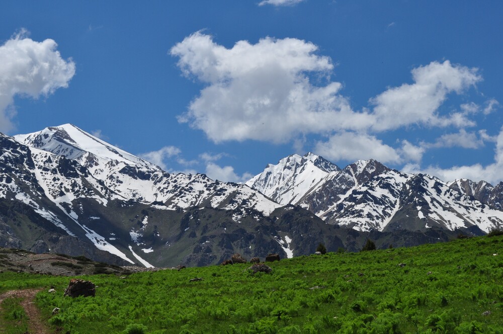
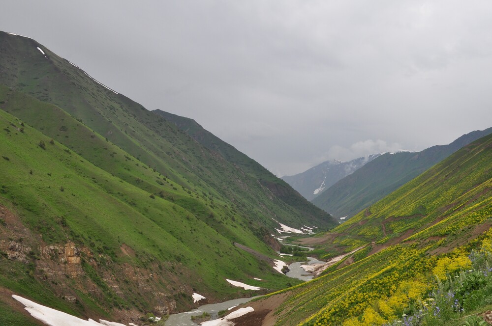
The extremes of geography along the routes graphically illustrate the challenges of this long distance trade. Falling to 154 metres below sea level and rising to 7,400 metres above sea level, the routes touch great rivers, alpine lakes, crusty salt flats, vast deserts, snow-capped mountains and ‘fecund’ prairies. The climate varies from extreme drought to semi-humid; while vegetation covers temperate forests, temperate deserts, temperate steppes, alpine steppes and oases.
Starting on the Loess plateau at Chang’an, the central capital of China in the Han and Tang Dynasties, the routes of the Tian-shan corridor passed westwards through the Hosi Corridor across the Qin and Qilian Mountains to the Yumen Pass of Dunhuang. From Loulan/Hami, they continued along the northern and southern flanks of the Tianshan Mountain and then through passes to reach the Ili, Chuy and Talas valleys in the Zhetysu Region of Central Asia, linking two of the great power centres that drove the Silk Roads trade.
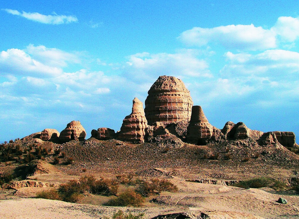
Thirty three sites along the corridor include capital cities palace complexes of various empires and Khan Kingdoms, trading settlements, Buddhist cave temples, ancient paths, posthouses, passes, beacon towers, sections of the Great Wall, fortifications, tombs and religious buildings. The formal system of posthouses and beacon towers provided by the Chinese Empire facilitated trade, as did the system of forts, caravanserai and way stations operated by states in the Zhetysu region. In and around Chang’an, a succession of palaces reflect the power centre of the Chinese Empire over 1,200 years; while the cities of the Chuy valley are witness to the power centre of the Zhetysu region from the 9th to the 14th centuries and their organisation of the long distance trade.
The series of Buddhist pagodas and large, elaborate cave temples extending from Kucha (now Kuqa County) in the west to Luoyong in the east, record the eastward transmission of Buddhism from India via Karakorum, and demonstrate an evolution in the design of stupas as local ideas were absorbed. Their elaboration reflects the sponsorship of local authorities and the central Chinese imperial government as well as donations of wealthy merchants, and the influence of monks that travelled the routes, many of whose journeys were documented from 2nd century BC onwards. Other religious buildings reflect the co-existence of many religions (as well as many ethnic groups) along the corridor including Zoroastrianism, the main religion of the Sogdians of Zhetysu region, Manichaeism in the Chuy and Talas valleys and in Qocho city and Luoyong, Nestorian Christianity also in Qocho city, around Xinjiang and in Chang’an, and Islam in Burana.
The massive scale of the trading activities fostered large, prosperous and thriving towns and cities that also reflect the interface between settled and nomadic communities in a variety of ways: the mutual inter-dependence of nomads and farmers and different peoples such as between Turks and Sogdians in the Zhetysu region; the transformation of nomadic communities to settled communities in the Tianshan Mountains, resulting in highly distinctive construction and planning such as semi-underground buildings; and in the Hosi corridor the planned agricultural expansion of the 1,000 mile corridor after the 1st century BC as an agricultural garrison and its transformation to settled agricultural communities. Diverse and large scale water management systems were essential to facilitate the growth of towns, trading settlements, forts, and caravanserai and the agriculture necessary to support them, such as the extensive Karez underground water channels of the extremely arid Turpan basin, many still in use, that supplied water to Qocho city, and were supplemented by deep wells inside Yar city; the grand scale of the network of open canals and ditches along the Hosi corridor that drew river water to the settlements, 90 km of which survive around Suoyang city; and in the Zhetsyu region, river water distribution through canals and pipes and collection in reservoirs.
As well as conduits for goods and people, the routes allowed the exceptional flow of ideas, beliefs and technological innovations such as those related to architecture and town planning that shaped the urban spaces and peoples’ lives in many fundamental ways.